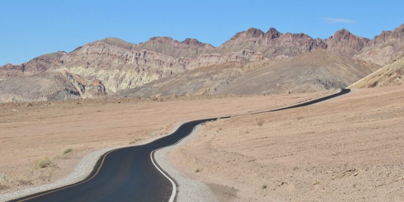
Death Valley National Park Along Artist’s Drive Death Valley National Park is located in Eastern California along the Nevada border. It is a land of contrasts, ranging from Telescope Peak at 11,049 feet, to Badwater Basin at 282 feet below sea level. It is one of the hottest and driest places on earth, registering the hottest day recorded anywhere on earth at 134 degrees F. photo by Jasperdo | Flickr(Noncommercial use allowed)
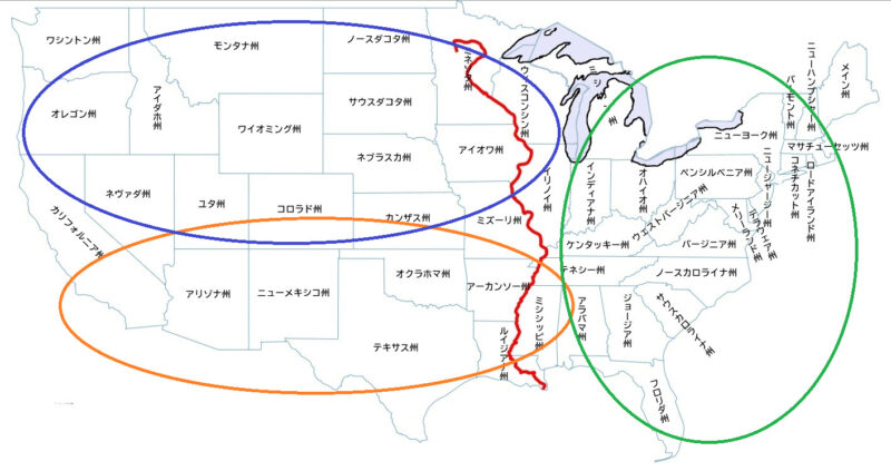
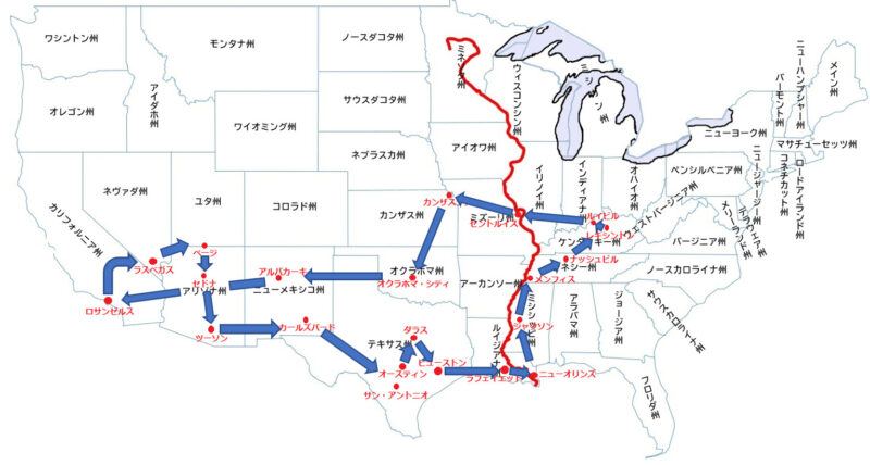
4.ラスベガス <ネヴァダ州>
Welcome to Fabulous Las Vegas The Welcome to Fabulous Las Vegas sign is a Las Vegas Strip landmark funded in May 1959 and erected soon after by Western Neon photo by Michael Koukoullis | Flickr(Noncommercial use allowed)
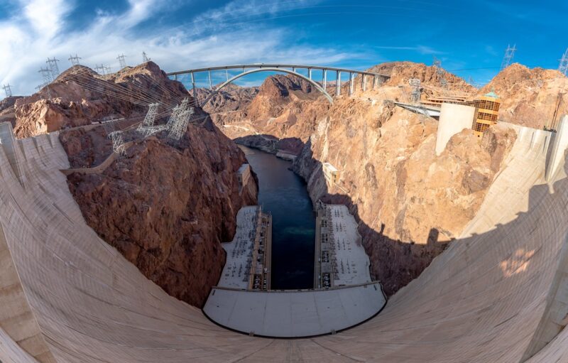
5.フーバーダム <ネヴァダ州>
Hoover Dam Pano Boulder City, Nevada USA photo by Keith Burton (flickr.com)(Noncommercial use allowed)
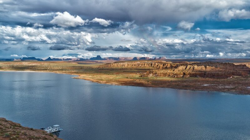
Lake Powell Lake Powell is a reservoir on the Colorado River, straddling the border between Utah and Arizona. It is a major vacation spot that around 2 million people visit every year. photo by Visavis.. | Flickr(Noncommercial use allowed)
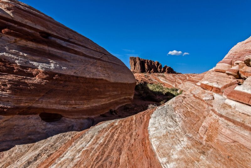
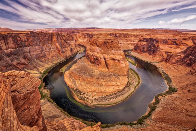
16.アンテロープキャニオン <アリゾナ州>
Lower Antelope Canyon – Page, Arizona photo by Kirk K (flickr.com)(Noncommercial use allowed)
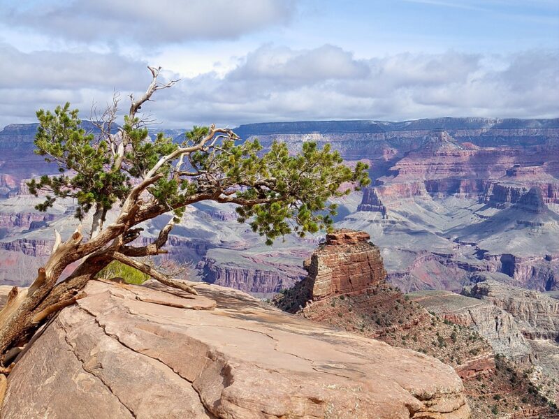
South Kaibab Trail tree – Grand Canyon photo by Al_HikesAZ (flickr.com)(Noncommercial use allowed)
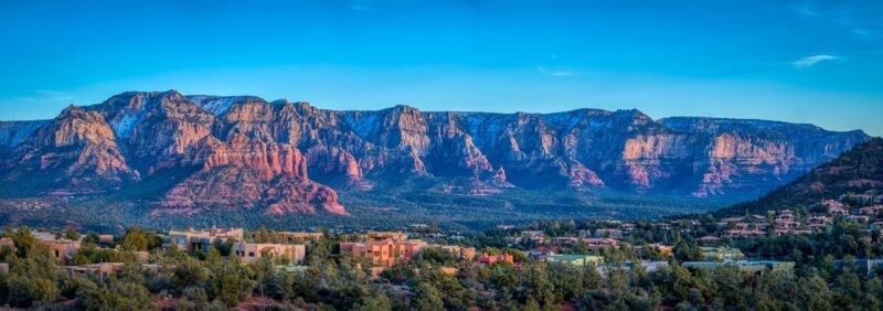
19.セドナ <アリゾナ州>
Sedona Pano Evening shot with. setting sun lighting up the red rocks in Sedona photo by CEBImagery | Flickr(Noncommercial use allowed)
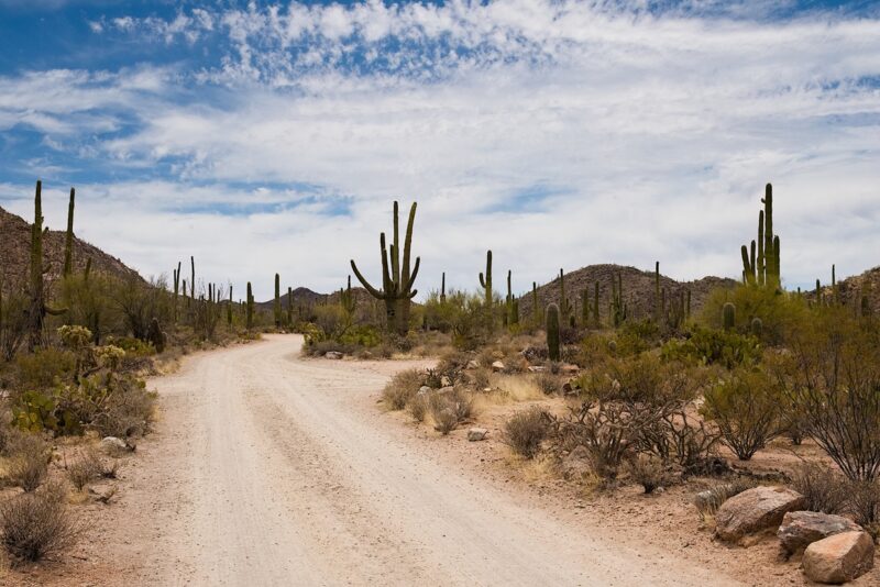
20.サワロ国立公園 <アリゾナ州>
This is the road that leads to the picnic area right outside of Saguaro National Park. photo by A Guy Named Nyal (flickr.com)(Noncommercial use allowed)
21.ホワイトサンズ国定公園 <ニューメキシコ州>
White Sands National Monument Located in southern New Mexico, just outside of the city of Alamogordo, White Sands National Monument preserves the largest gypsum dune field in the world. Dunes Drive ventures 8 miles into the heart of the dunes. photo by Jasperdo | Flickr(Noncommercial use allowed)
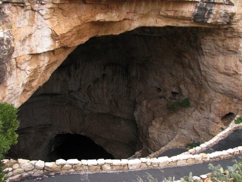
22.カールスバッド国立公園 <ニューメキシコ州>
carlsbadcaverns-03 A trip to Carlsbad Caverns National Park, walking down the main entrance and then through the Big Room through one of the most famous show caves in the world. While I took hundreds of photos, most of them ended up too blurry because the exposure time was usually between 2.5 and 4 seconds per picture, and it’s not exactly easy to hold a camera perfectly still that long. (Note: Take along a tripod or some other stabilizing tool next time, it’s not like you’re in any rush so there’s plenty of time to set it up and do it right.) In the photos there are plenty of yellow and green (and sometimes reddish) lights, but inside the cavern the light level is so low that you barely (or never) notice the colors at all. There are other paid, guided tours you can take as well, including some serious spelunking — I took the King’s Room tour, but the group was so large with middle school kids that I didn’t have an opportunity to take photos on that leg of the journey. And despite all of my traveling, this was actually the first time I had wandered outside of Texas in over three years. photo by mlhradio (flickr.com)(Noncommercial use allowed)
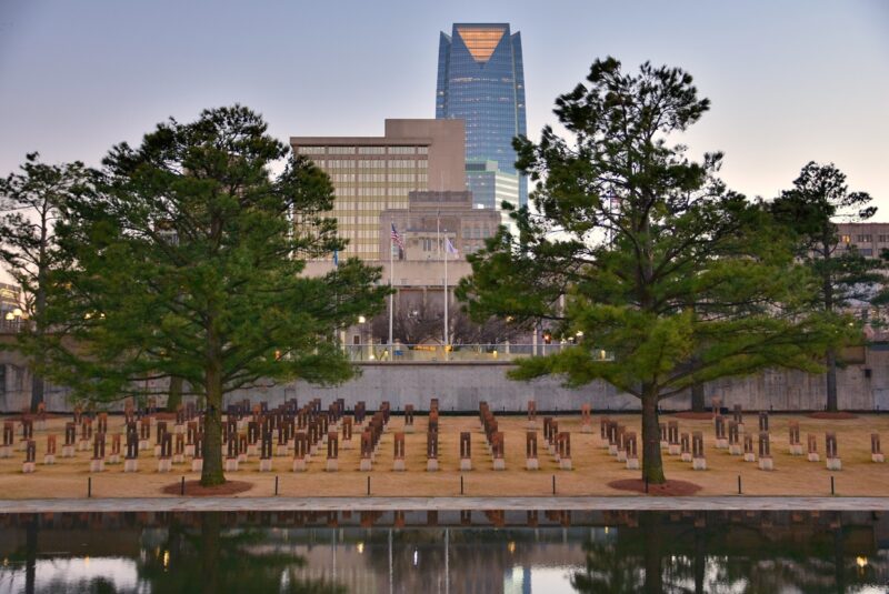
Oklahoma City Memorial The Oklahoma City National Memorial recognizes the rescuers, survivors and 168 people who lost their lives in the 1995 Alfred P. Murrah Federal Building bombing. Chairs representing each individual killed in the attack line the granite reflecting pool next to the museum. There are bronze gates on each end marked with the times before and after the attack occurred. This is a powerful, solemn place, and I recommend it not be missed if you are anywhere in the area. photo by jpellgen (@1179_jp) | Flickr(Noncommercial use allowed)
40.(サンタフェ) <ニューメキシコ州>
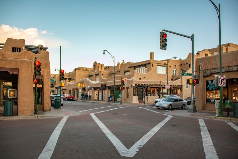
Downtown Santa Fe At the Santa Fe Plaza photo by Kent Kanouse | Flickr(Noncommercial use allowed)
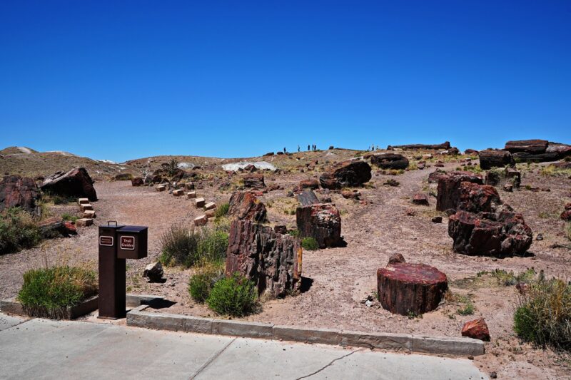
Rainbow Forest Trails – Petrified Forest National Park I was starting to feel pressed for time. Our last stop was Rainbow Forest Museum and Trail. Lots of great information in this smallish museum. Lots of paleontology explanations. There is a nice paved trail for exploring. We did not have time to hike around. You can see the petrified tree pieces scattered around on the trail. It is amazing to see the magical transformation petrification creates in these trees. photo by Al_HikesAZ | Flickr(Noncommercial use allowed)
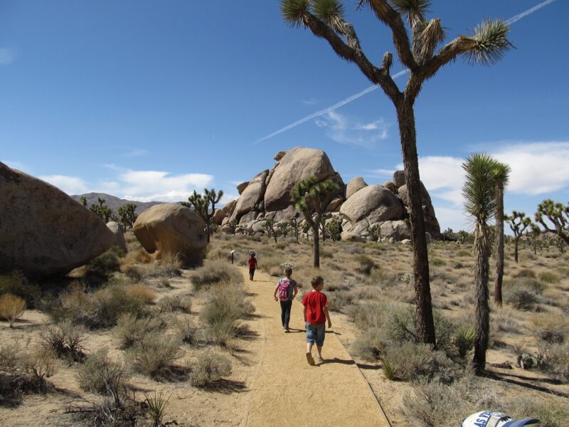
43.(ジョシュア・ツリー国立公園) <カリフォルニア州>
Cap Rock Hike, Joshua Tree National Park, California Joshua Tree National Park is located in southeastern California. Declared a U.S. National Park in 1994 when the U.S. Congress passed the California Desert Protection Act (Public Law 103-433), it had previously been a U.S. National Monument since 1936. It is named for the Joshua tree (Yucca brevifolia) forests native to the park. It covers a land area of 789,745 acres (319,598 ha). A large part of the park is designated to wilderness area—some 429,690 acres (173,890 ha). Straddling the San Bernardino County/Riverside County border, the park includes parts of two deserts, each an ecosystem whose characteristics are determined primarily by elevation: the higher Mojave Desert and lower Colorado Desert. The Little San Bernardino Mountains run through the southwest edge of the park. photo by Ken Lund (flickr.com)(Noncommercial use allowed)
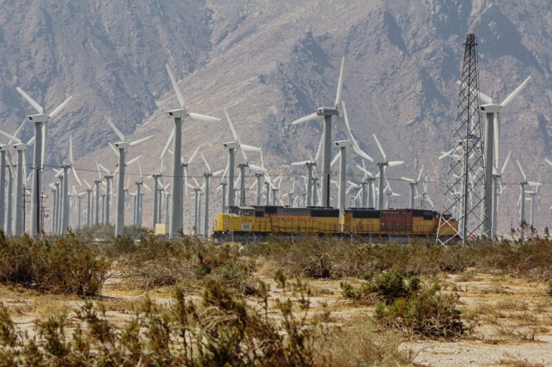
44.(パーム・スプリングス) <カリフォルニア州>
Palm Springs, California The wind farm on the San Gorgonio Mountain Pass in the San Bernadino Mountains contains more than 4000 separate windmills and provides enough electricity to power Palm Springs and the entire Coachella Valley. photo by Photos By Clark (flickr.com)(Noncommercial use allowed)


コメント